Drone imagery, 360° tours and mapping for property, construction and land.
From detailed property tours to aerial film and measured land maps, Fidra Media helps clients see places clearly, present them at their best and understand how they change over time. Based in East Lothian, working across Scotland.
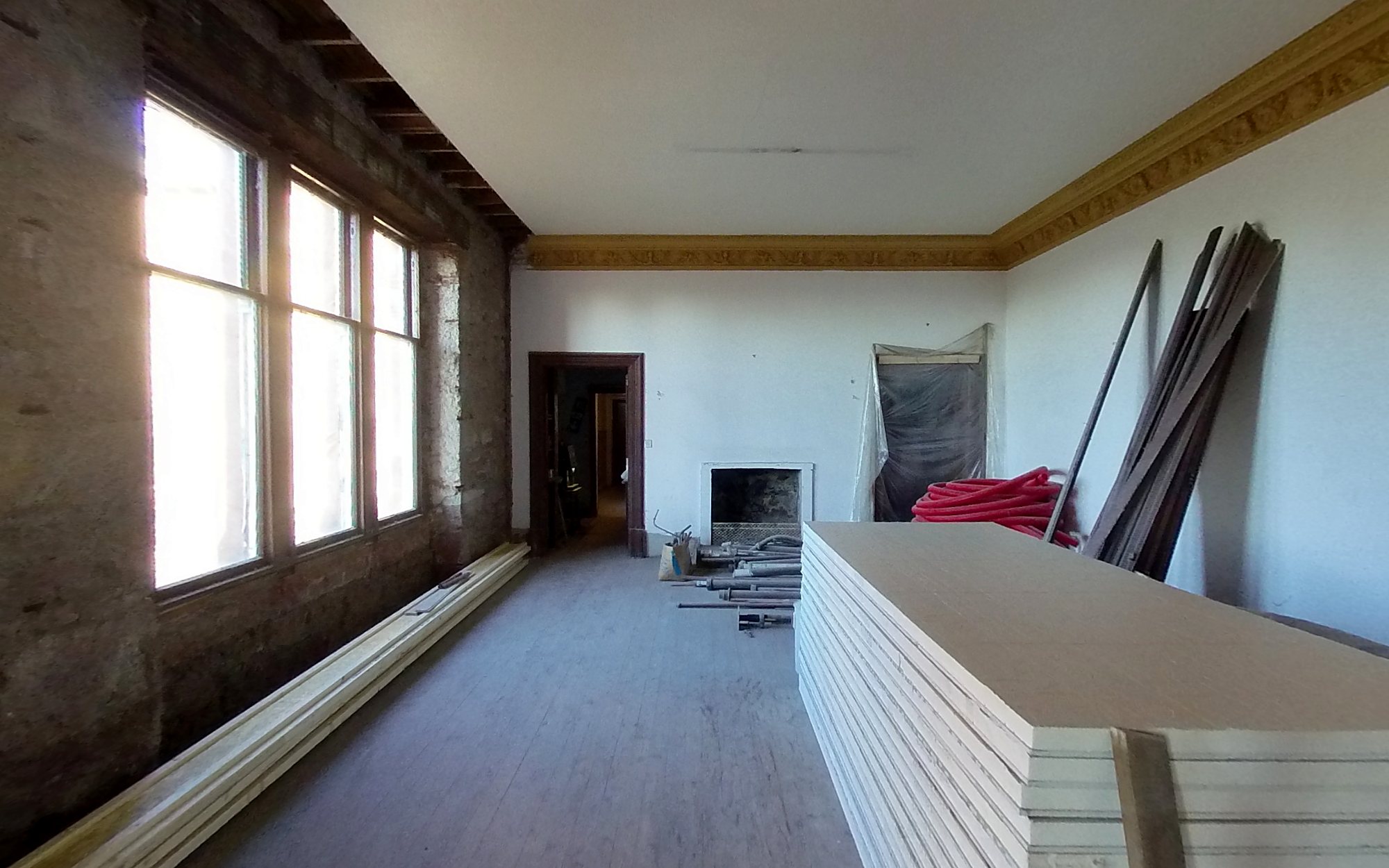
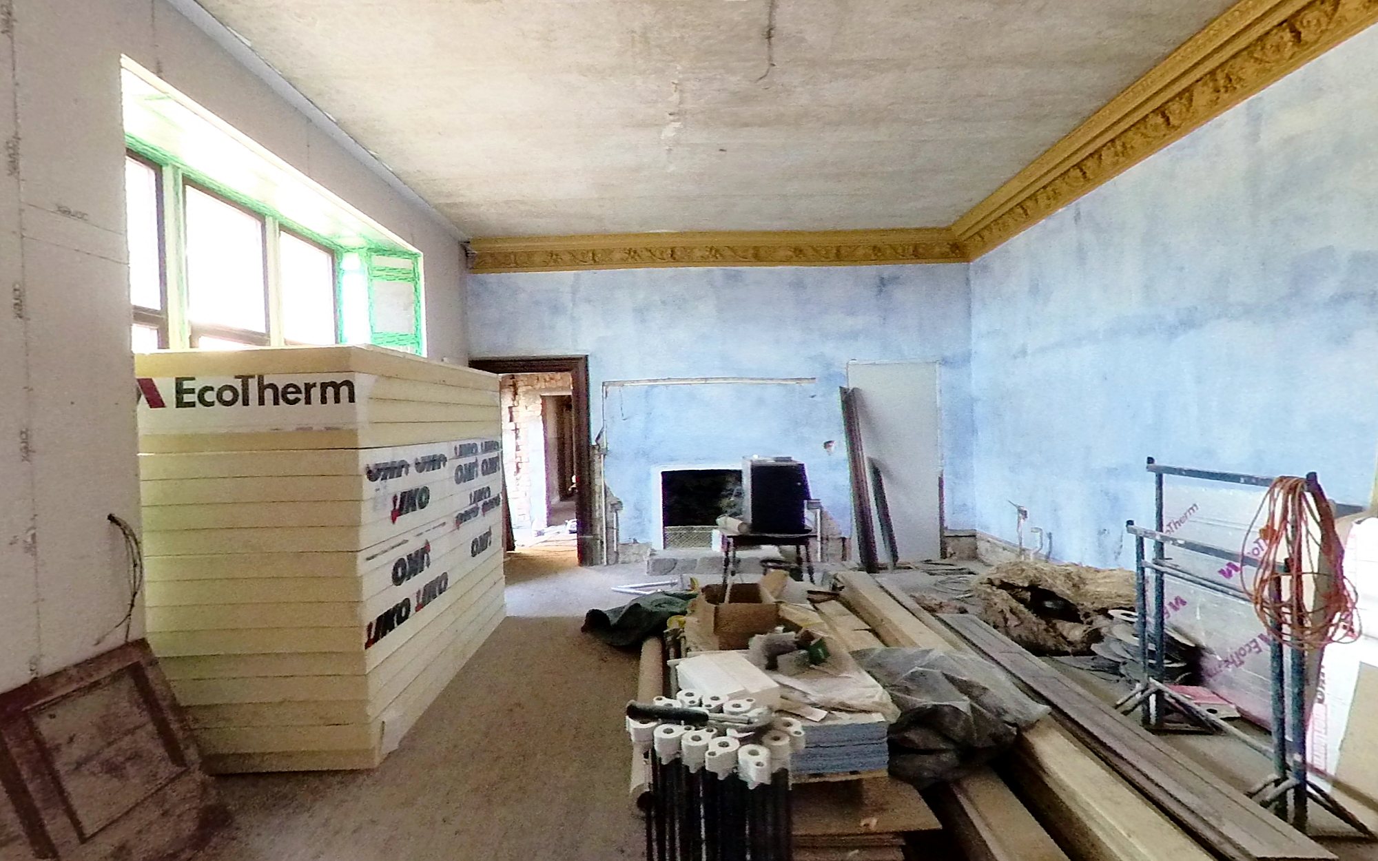
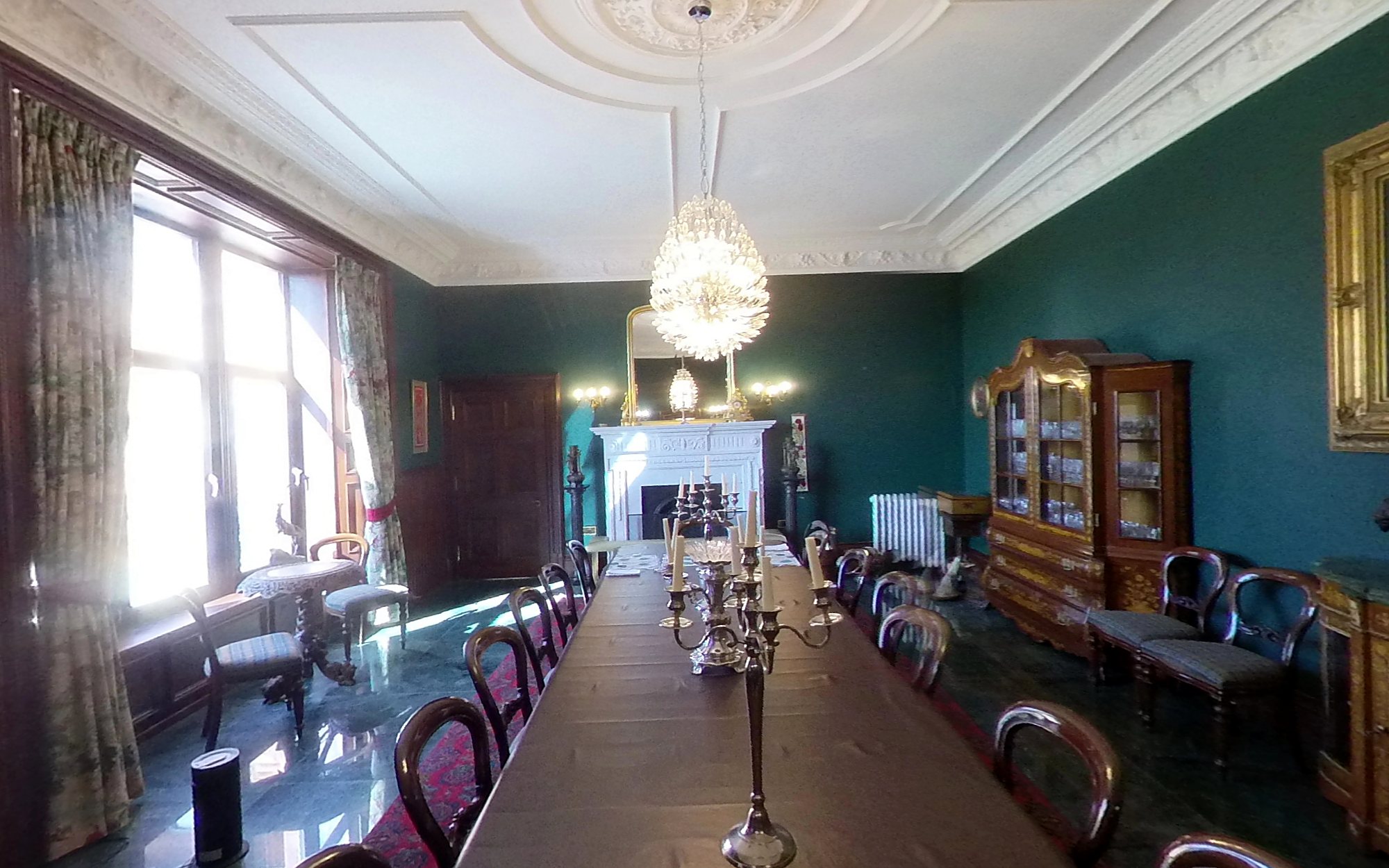
The dining room at Park Hill, recorded across three visits. Compare the bare stone walls of January 2021 with the plaster and insulation of April 2022, and the finished room in April 2025.
Jan 2021Apr 2022Apr 2025
Three visits, the same room, a clear record of the transformation. Drag the handles to compare the images.
Look around Park Hill
A property best explored in 360°.
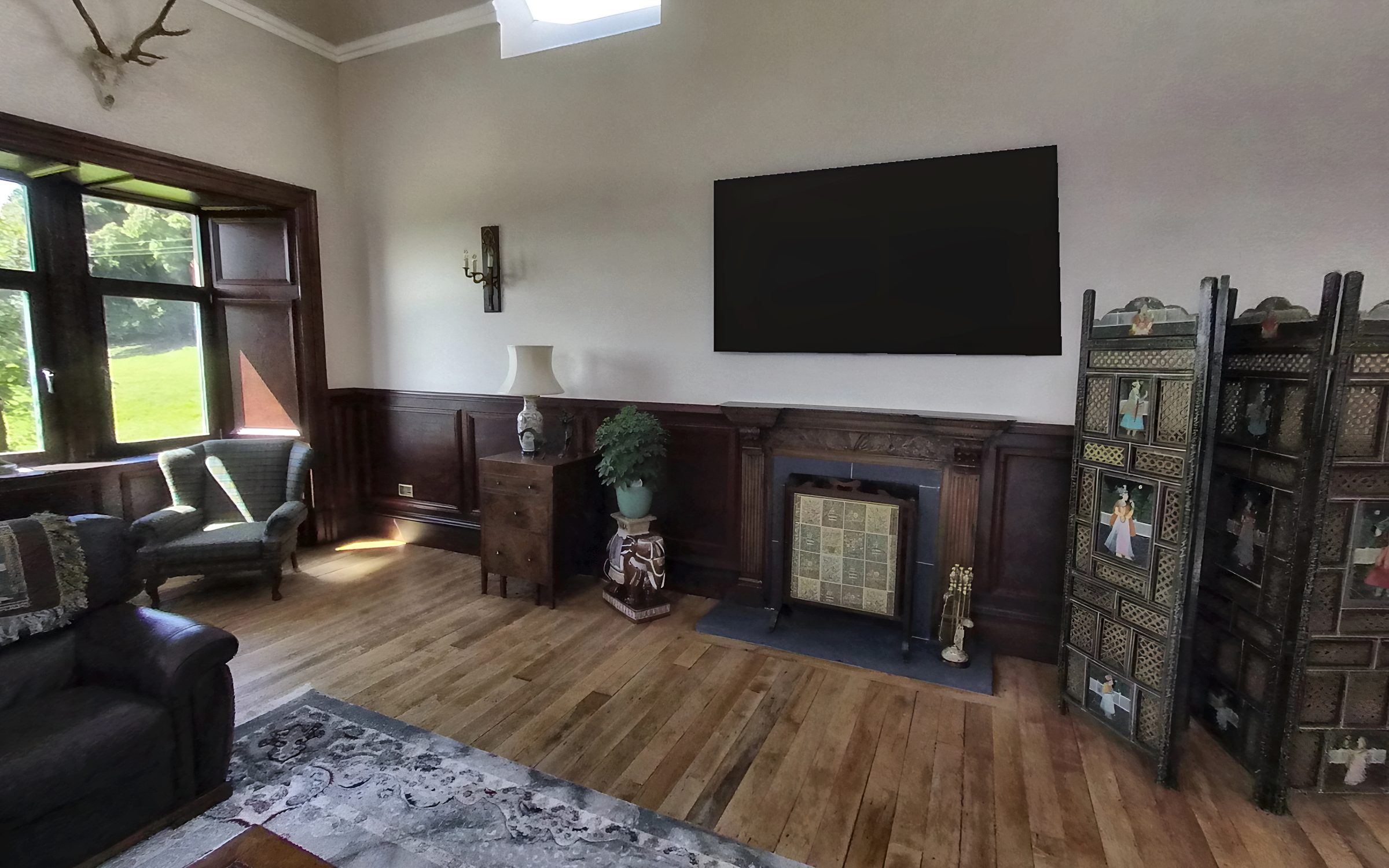
Explore the house and grounds through real 360° photography captured at Park Hill, a country estate documented throughout its renovation. Take an aerial view of the estate, step inside as the building work progresses or look around the newly completed pool. Drag to explore each scene and see the property from every angle.
From the air
Inside the house
August 2024: an aerial view of the house and grounds in high summer. Drag to look around.
Each aerial 360° panorama is created by stitching together 35–60 drone photographs. Pinch or scroll to zoom, or switch to full screen for a closer look.
Our services
Three specialist services. One point of contact.
Whether you need to showcase a property, document a construction project or understand a piece of land, we bring the right combination of photography, aerial imagery and mapping to the job. Book an individual service or combine several in one visit. You'll receive a preview of the results before payment.
360° tours for property and construction
Most booked
Explore every room. See the whole property.
Give prospective buyers, guests and project stakeholders a better sense of a place with an interactive tour that connects interior spaces with an aerial 360° view. Visitors can explore at their own pace using a phone, tablet or computer, without installing an app.
Ground-level 360° photography of principal rooms and outdoor spaces
Aerial 360° panoramas showing the property and its surroundings
A hosted tour with a shareable link and website embed code
Repeat tours from consistent viewpoints to document construction and renovation
Ideal for: estate agents, holiday lets, country houses, venues, builders and renovation projects
Drone photos and film
A wider view of the property, its setting and its surroundings.
Professional aerial photography and film show the relationship between a building, its grounds and the wider landscape. From property marketing to architectural portfolios, we create imagery suited to the purpose of each project.
Edited aerial photographs for property listings, websites and print
Short films for websites, presentations and social media
Wide aerial panoramas of buildings, grounds and surrounding land
Ideal for: architects, estate agents, hotels, landowners and property developers
Construction progress and renovation records
Repeat visits
A clear record of what changes, and when.
Consistent aerial and interior 360° photography creates a visual record of a project from the first stages of work through to completion. Returning to the same viewpoints makes it easier to compare visits and see progress over time.
Repeat aerial 360° panoramas from matching viewpoints
Interior 360° records at key construction stages, including before walls are closed up
Scheduled monthly, quarterly or milestone visits
An accessible visual record to share with owners, clients and project teams
Ideal for: builders, developers, self-builders and owners managing renovations from a distance
Mapping, boundaries and GIS
Turn aerial data into practical information about your land.
Drone mapping combines detailed aerial imagery with geographic information to help landowners and professionals understand sites, measure areas and assess features. Outputs can include mapped boundaries, orthomosaic imagery, elevation data and 3D models, depending on the project requirements.
Aerial maps with boundaries, features and areas marked
Measured imagery of plots, fields, woodland and estates
Elevation data, terrain models and 3D representations
GIS-ready files for mapping, analysis and planning workflows
Ideal for: estates, farms, golf courses, care homes, builders, architects and planners
Mapping and GIS
Maps and reports for the land you look after.
A single drone survey can provide a detailed aerial record of a site, with the potential to produce several useful outputs. The right deliverables depend on the land, the questions being asked and how the information will be used. From estate boundaries and field areas to construction sites and golf course features, we tailor mapping outputs to the needs of each client. Based in Gullane, we work with landowners and businesses throughout East Lothian and across Scotland.
Illustrative layout
Boundary and land map
Know what's where. Understand the land you manage.
Aerial imagery provides a clear backdrop for mapped boundaries, land parcels and key features. The resulting map can help owners, land agents and other stakeholders discuss a site using the same visual reference.
Boundary
Parkland
Woodland
Arable land
1The house
2Main drive
3Tree flagged for a safety check
4Field gate on the boundary
Depending on the scope of the project, deliverables can include:
Boundary lines reviewed against visible ground features and available reference information
Areas for fields, woodland and other land parcels, in hectares and acres
Numbered locations for trees, gates, access points and other features requiring attention
GIS-compatible files, Google Earth data and a printable PDF
Useful for: estate management, landowners, land agents and property professionals
Mapping outputs are prepared to the agreed specification. Where legal boundary determination or a formal land survey is required, an appropriately qualified surveyor may be needed.
Illustrative layout
Farm buildings and roof report
Every building and field on one page, with roofs graded from the air. No ladders, no one on the roof, and a clear list of what needs fixing first.
Roof: fix soon
Roof: keep an eye on
Roof: good
Fence to repair
1Rusted sheets and holes
2Cracked fibre-cement sheets
3Moss and slipped slates
4Fence line to repair, about 160 m
5Field gate
What you get
Roof area and condition for every building, graded red, amber and green
Close-up photos of each problem, pinned on the map
Field areas and fence lengths for grants and records
A simple report you can hand to a builder or insurer
Good for: farms, steadings, rural businesses, insurers
Illustrative layout
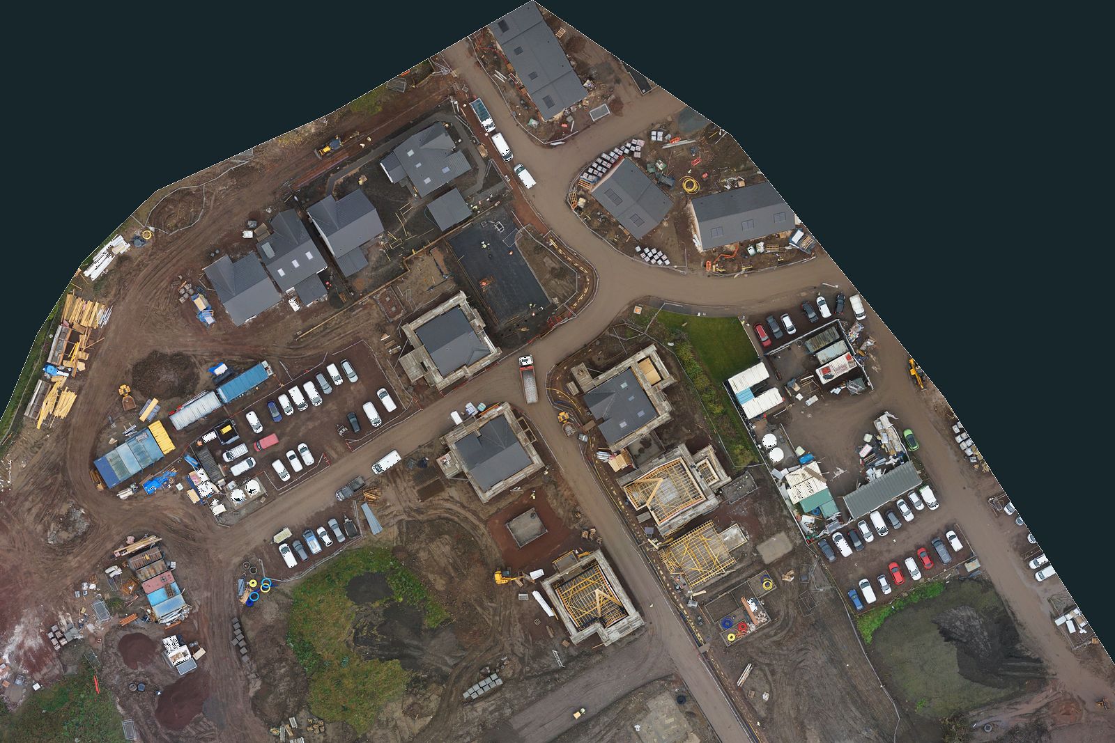
Site progress map
A measured, straight-down map of the whole site on every visit, with each plot coloured by stage. Built from a real 2 cm survey, so the scale bar and the areas are true.
Finished
Roof on
Timber frame
Foundations
Compound and storage
Numbers are plot numbers
Dashed white line is the haul road
Scale bar and north arrow are true to the survey
What you get
Measured map you can scale from, to about 2 cm a pixel
Plots coloured by stage, so progress is clear at a glance
Stockpile volumes and areas on request
Same flight path every visit, so maps line up month to month
Good for: house builders, developers, project managers, funders
Illustrative layout
Grounds and safety plan
A clear, up-to-date plan of the building and grounds for fire plans, inspections and contractors, plus a roof check without scaffolding.
Building
Fire engine access
Assembly point
Grounds boundary
1Chimney pointing worn
2Slipped slates over the bay
3Lead flashing to check
4Tree within 10 m of the building
What you get
Aerial site plan with access, parking and assembly points
Roof and chimney check, with close-up photos
Trees near the building flagged for a closer look
360 tour of rooms for families, guests or new staff
Good for: care homes, hotels, schools, venues
Illustrative layout
Property sale and guest map
Show buyers or guests exactly what comes with the property: the land, the shore, the walk to the beach and how to get there.
Garden
Shore line
Track
1Cottage
2Boathouse
3Slipway
4Burn for the water supply
What you get
Land and garden marked, with areas
Distances that matter: to the beach, the road, the village
Labelled aerial photos and a short film for the listing
A 360 tour so guests can look round before they book
Good for: holiday lets, estate agents, sellers, glamping sites
Golf courses
A clearer view of the course, from tee to green. Aerial imagery can support course presentation, maintenance planning and the management of grounds and infrastructure. Services can include hole-by-hole aerial films for marketing and course presentation, aerial course maps for operational reference, and aerial inspections and mapping of trees, bunkers and visible drainage features. Ask about a sample flight over one hole of your course.
Mapping examples: practical outputs from real projects.
Every site presents different challenges. These examples show how aerial imagery and mapping can help make land, terrain and structures easier to understand.
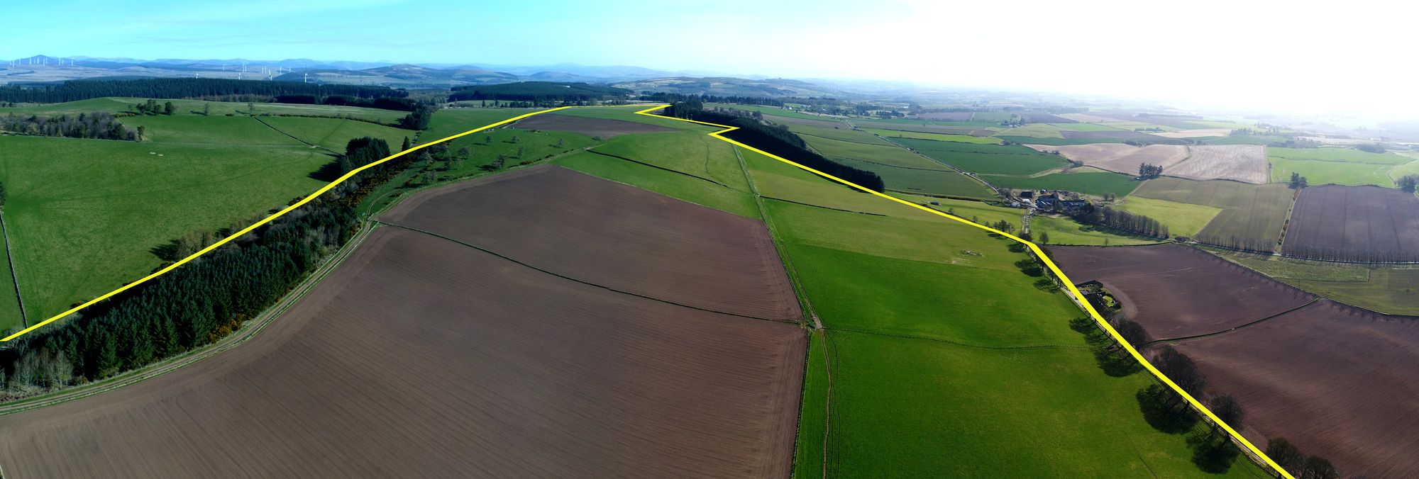
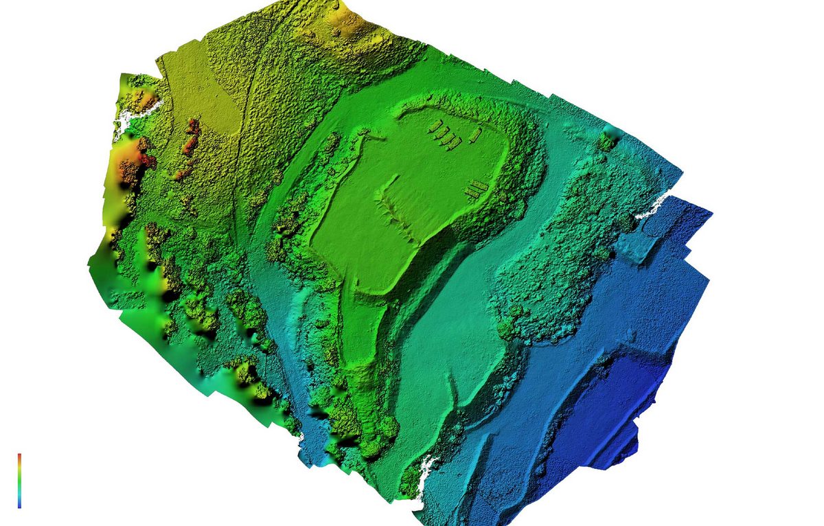
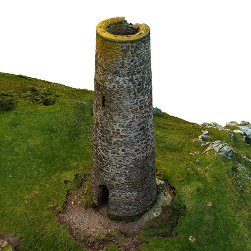
Park Hill: the estate boundary marked on an aerial panorama, 2025Ground height map from a drone survey3D model of a stone tower
BoundariesAerial imagery with land boundaries clearly marked, helping owners and agents visualise property extents and surrounding land.
Measured aerial mapsDetailed, stitched aerial imagery designed to provide a clear view of a site and support measurement where the data and specification are suitable.
Elevation and 3D modelsTerrain data, height information and 3D representations to support site assessment, design discussions and planning work.
GIS-ready filesOutputs such as GeoTIFF, KML and shapefiles for use in compatible software, including QGIS, ArcGIS and Google Earth.
Specialist imagery and mapping for the people who manage, design and develop places.
Different projects need different information. We tailor the approach and deliverables to the property, site and intended use.
Estates and farms
Aerial imagery, boundary mapping, field and woodland areas, and roof inspections to support land management and property records.
Golf courses
Aerial flyovers, course imagery and mapping of visible features to support presentation and grounds management.
Holiday lets and property sales
Interactive 360° tours and professional aerial imagery that help prospective buyers and guests explore a property before visiting.
Care homes and hotels
Property tours, aerial photography, grounds mapping and visual inspections to support presentation and estate management.
Builders and developers
Repeat photography, construction progress records and site mapping to help communicate changes throughout a project.
Architects and planners
Aerial site imagery, terrain information, 3D models and surrounding context to inform early-stage design and site assessment.
Recent work
Real projects. Real places. Work that speaks for itself.
From remote Highland estates to contemporary architecture, our projects show how aerial photography, film, 360° tours and mapping can bring a place into focus.
Mallaig Mhor, Loch Nevis
Aerial filmPanoramasProperty marketing
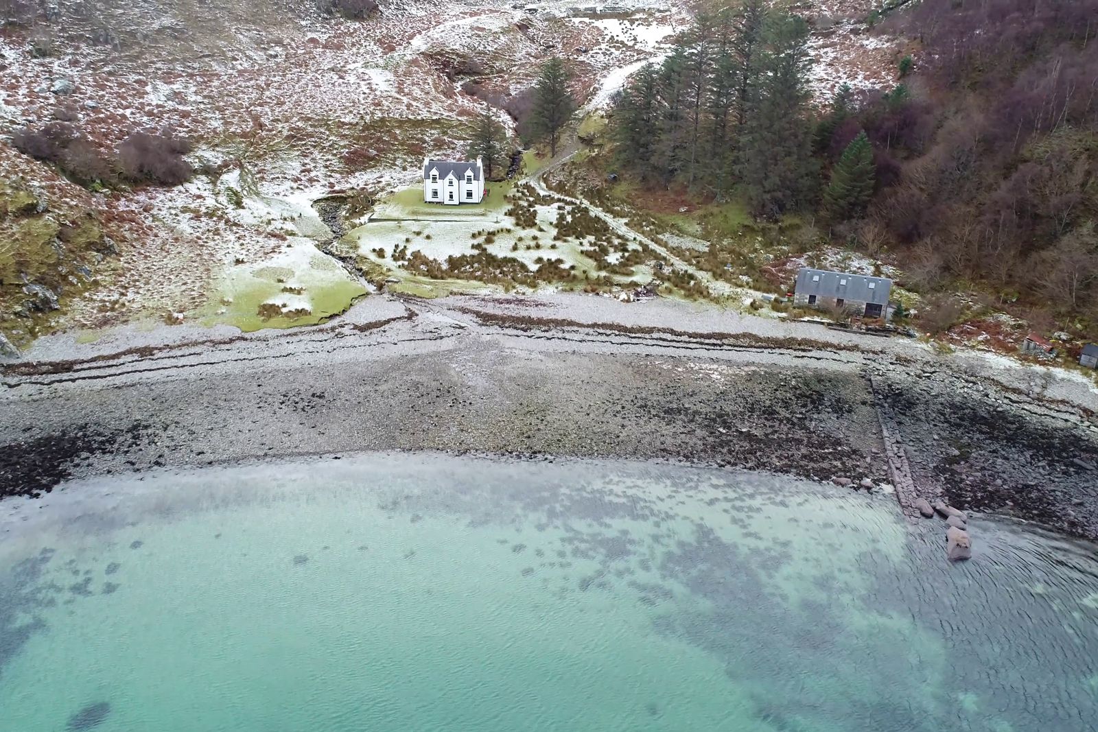
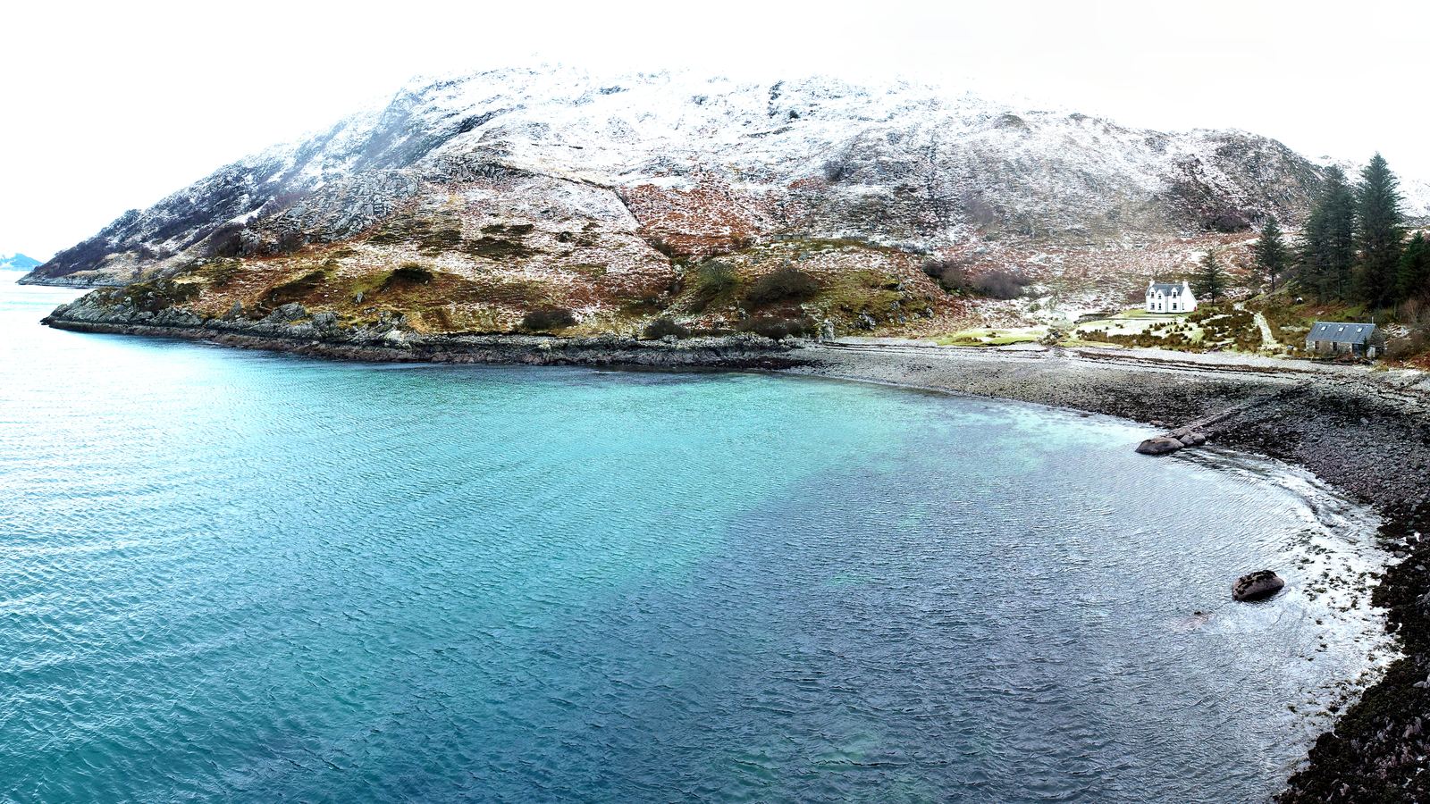
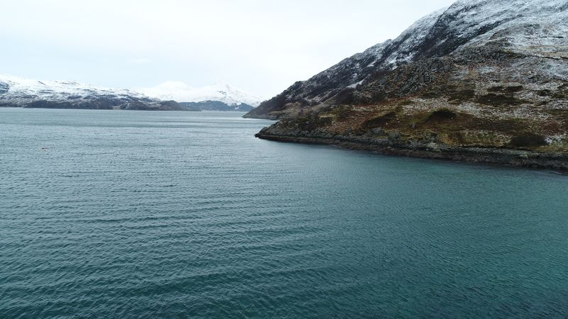
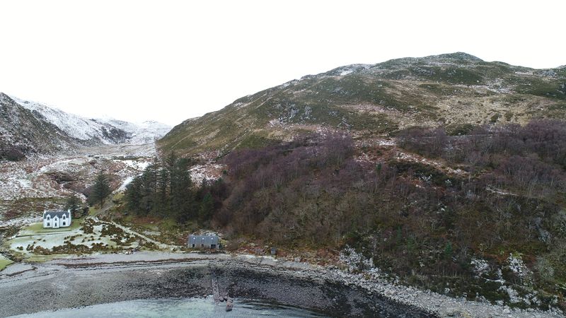
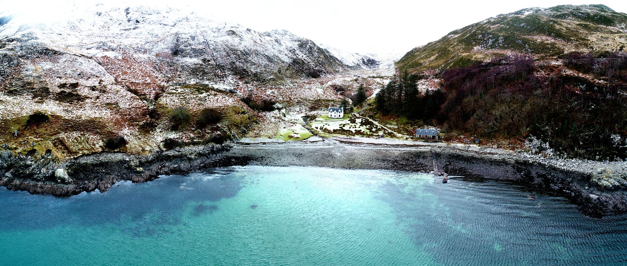
An 847-acre coastal croft at the mouth of Loch Nevis, photographed and filmed to support its sale. Captured on a clear winter day, the sequence begins over the water, moves towards the boathouse and ruins, follows the coastline and finishes with a view towards Mallaig. The resulting imagery captures both the character of the property and the scale of its remarkable coastal setting.
Mallaig Mhor bay
Loch NevisThe hillside above the shore
Aerial panorama of the bay, stitched from 13 photographs
Blackford Hill House, Edinburgh
Aerial filmAerial photographyFor Zone Architects
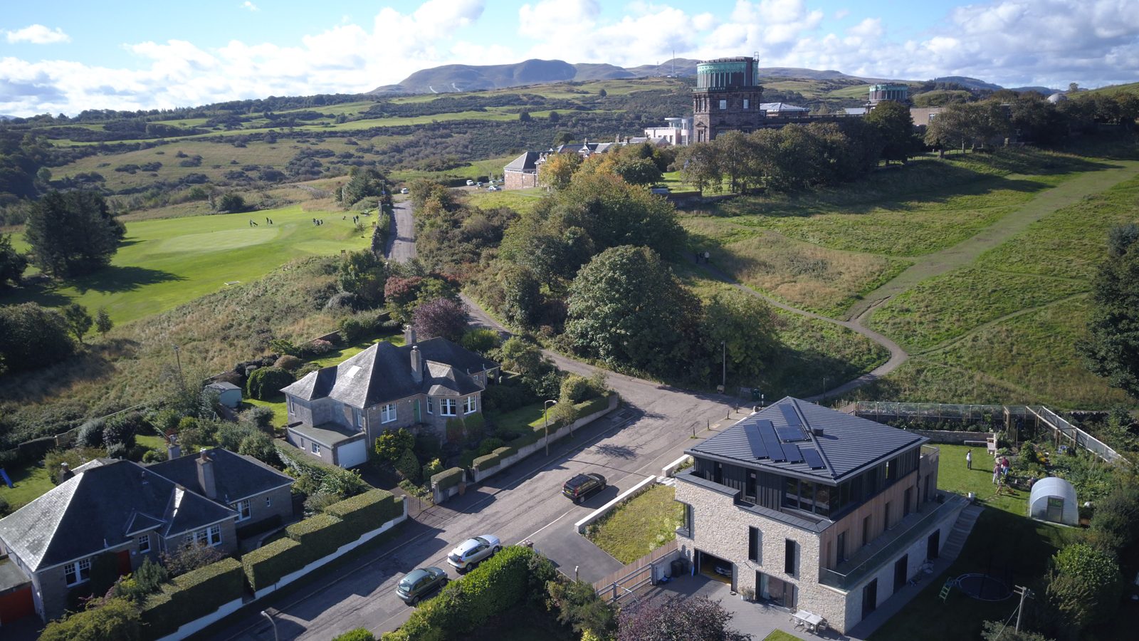
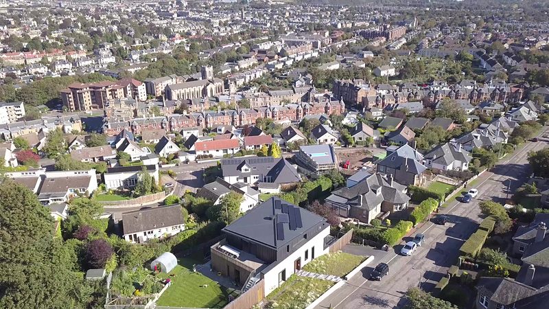
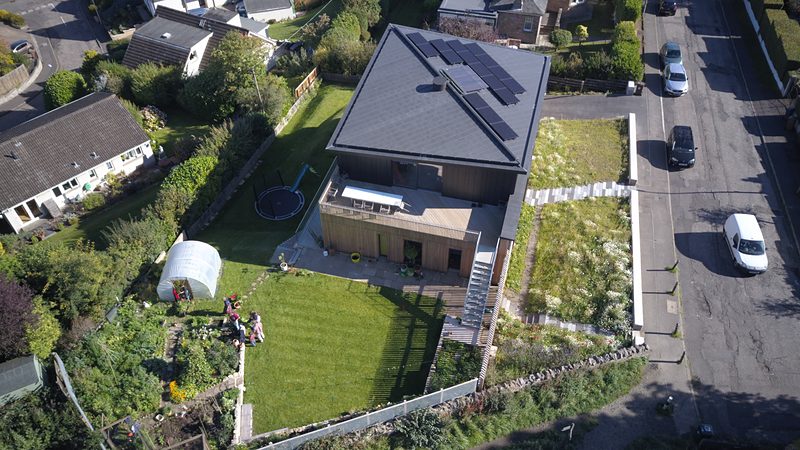
A contemporary family home set on the slopes of Blackford Hill. Designed by Zone Architects, the house places its main living spaces upstairs to make the most of the surrounding views. Aerial photography and film capture the architecture, its setting and its relationship with the wider city, from the house and garden to the Royal Observatory and Arthur's Seat.
The house with the Royal Observatory behind
Looking north towards Arthur's SeatThe house and garden from above
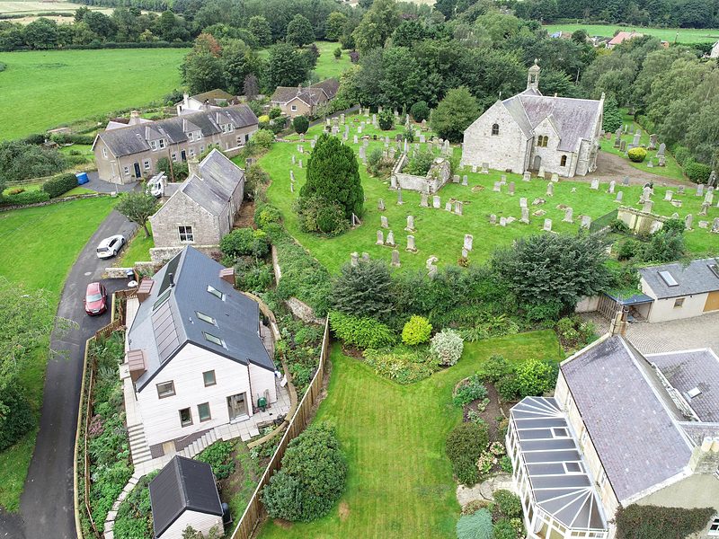
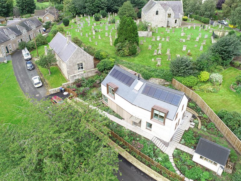
The Beekeeper's House, Roxburgh
Aerial filmAerial photographyFor Zone Architects
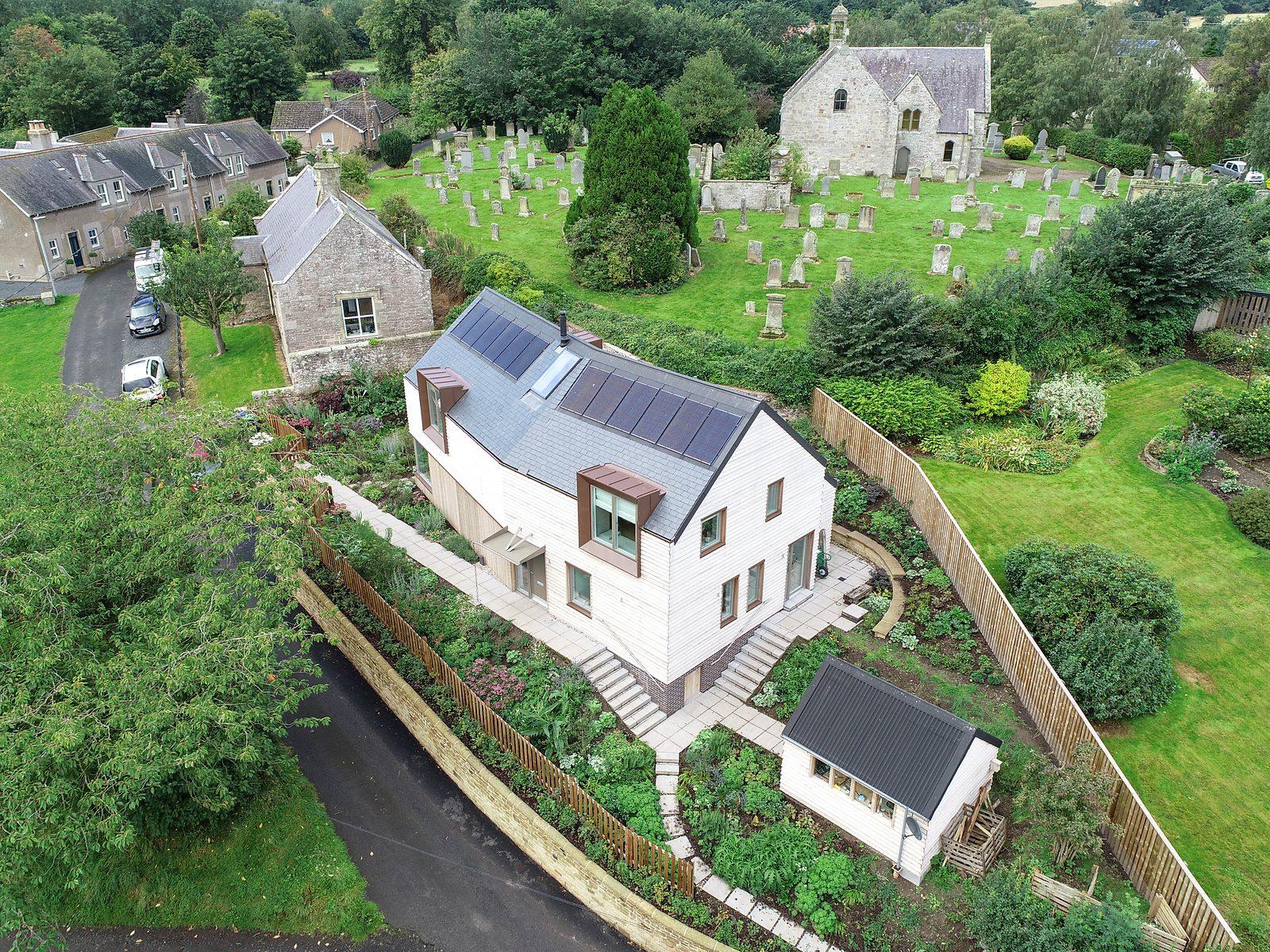
A new timber-framed home in the Scottish Borders village of Roxburgh, near Kelso. Set on a steep plot beside the old churchyard, the house steps down the slope and sits within the surrounding village landscape. Aerial imagery reveals the relationship between the building, its terraced garden, the neighbouring properties and the wider setting.
The house and its terraced garden
The house from the laneThe property beside the old churchyard
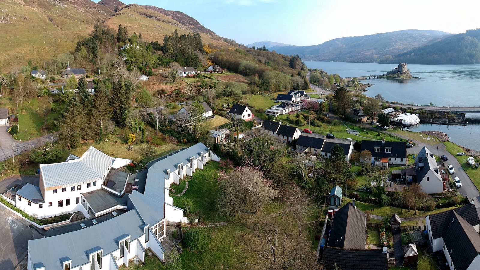
Dornie, near Eilean Donan Castle
Aerial filmPanoramasAerial photography
A property in Dornie, with views across Loch Duich towards Eilean Donan Castle. Spring blossom, open water and the iconic Highland setting provide the backdrop for a series of aerial photographs and film. The imagery captures the property in context, showing the village, the loch and the landscape beyond.
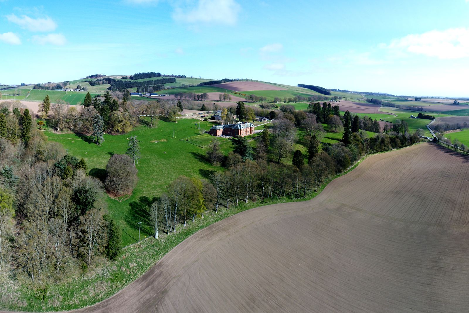
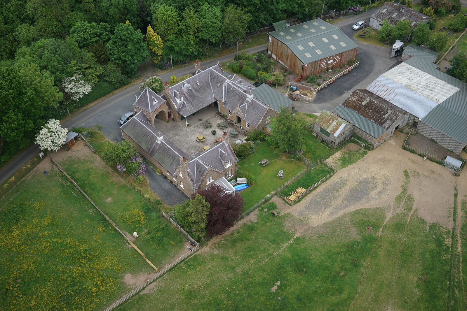
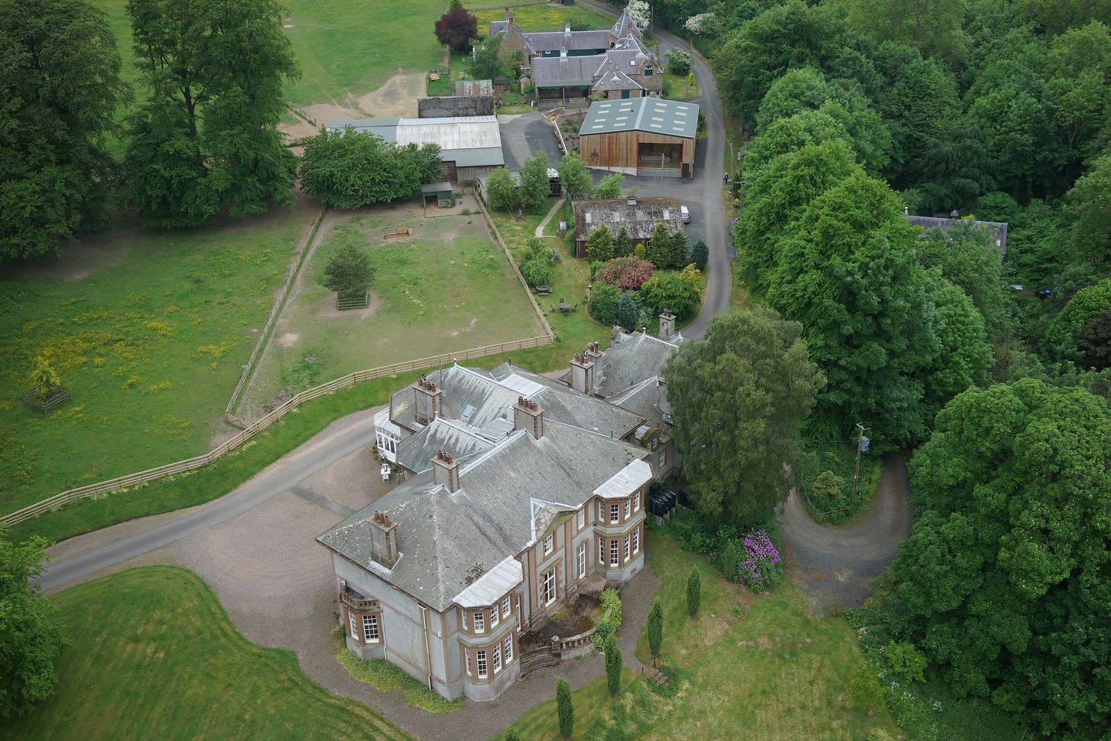
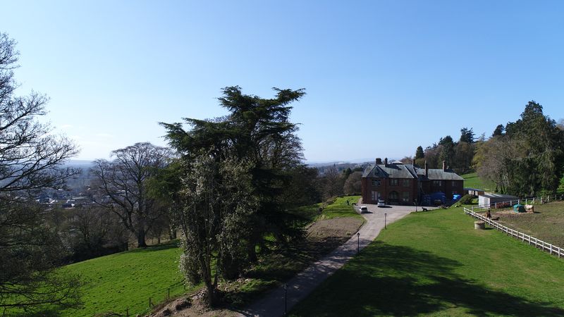
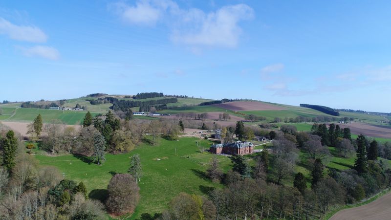
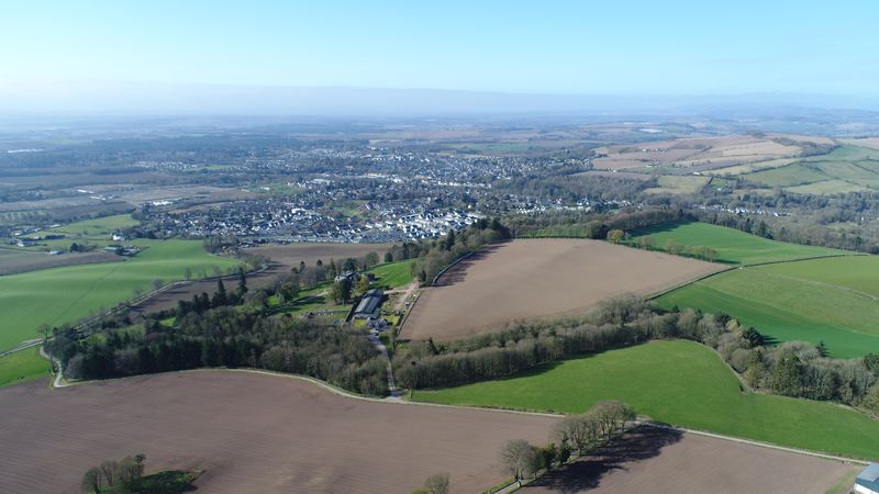
Park Hill is a country house and estate that we've documented throughout its renovation, beginning in April 2022. Each visit adds to the visual record, combining aerial 360° panoramas, interior tours and photographs to show how the property and grounds evolve. The work now extends to mapping the estate boundary, providing an additional view of the land alongside the photographic record. Park Hill brings several services together in one ongoing project: visual documentation of the property, construction progress and mapping of the land.
The house and its cedar treeThe house and surrounding groundsAerial views across the estate towards the town
Every job can end with a short film.
A different perspective on a remarkable place. Mallaig Mhor, filmed for its sale after a fresh dusting of snow. The sequence moves above the old ruins, out across the bay and towards the cottage, capturing the scale and character of the landscape. Aerial film can be commissioned as a standalone service or alongside photography, 360° tours and mapping.
Straightforward from first enquiry to final delivery.
No upfront payment. See a preview before you pay.
Tell us about the project
Share the location, what you need and your preferred timing. We'll review the requirements and provide a fixed quote, usually within one or two days.
We plan and capture
We check weather conditions, airspace restrictions and site access before arranging the visit. Photography, filming and mapping are carried out to the agreed scope.
Review a preview
Within a few days, you'll receive a preview of the tour and photographs, where applicable, so you can review the results before payment.
Approve and receive your files
Once approved and paid for, your finished work is delivered with the agreed links, embed code, photographs, videos and mapping files.
Frequently asked questions
How do people view a 360° tour?
Tours open in a web browser on a phone, tablet or computer. Visitors can drag to look around, move between viewpoints and explore the property at their own pace. No app is required.
Can we add the tour to our own website?
Yes. We provide a hosted tour link and an embed code, allowing the tour to be incorporated into a compatible website. The hosted link can also be shared by email or through property listings and social media.
What happens if the weather is bad?
Weather and flying conditions are checked before each job. If conditions make the planned flight unsafe or unsuitable, we'll discuss rearranging the visit. The approach depends on the service booked and the conditions at the time.
What do we receive from a mapping project?
Deliverables depend on the requirements agreed at the outset. These may include stitched aerial imagery, mapped boundaries and features, area measurements, elevation data, 3D models and compatible GIS files. We'll confirm the outputs and their intended use before the work begins.
How far do you travel?
We're based in Gullane, East Lothian, and work across Scotland. Travel and any associated costs are confirmed in the quote, based on the location and scope of the project.
The lighthouse in our branding is Fidra, the island just off the East Lothian coast.
About Fidra Media
Local knowledge. Commercial drone experience. A practical approach.
Fidra Media brings together aerial photography, 360° imaging and mapping to help people understand, document and present properties and land.
Our background includes ten years of commercial drone operations across wind turbines, power lines and industrial sites, alongside the production of maps and 3D models from aerial data. That experience informs the way we approach every project, from the planning and capture through to the finished deliverables.
Today, we apply the same attention to detail to homes, estates, construction projects and the wider landscape. From interior 360° tours to aerial film and GIS-ready mapping, each job is planned around what the client needs to see, communicate or understand.
Based in Gullane, East Lothian, we work across Scotland and offer weekend visits by arrangement.
Get a quote
Tell us about your property or project.
Whether you need a 360° tour, aerial photography, construction progress records or a detailed map of your land, we'll help you identify the right approach and provide a clear, fixed price.
Tell us where the property is and what you need. We'll get back to you, usually within one or two days.